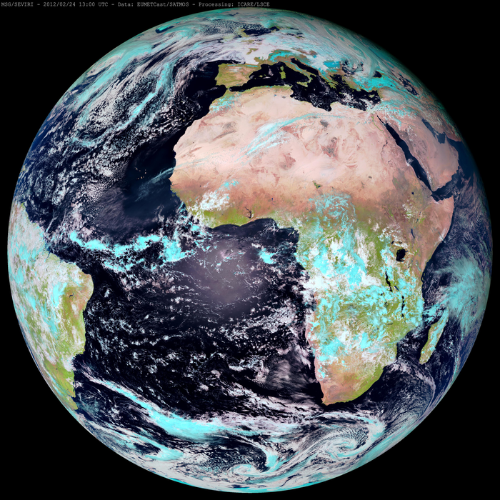
ICARE generates and distributes several MSG/SEVIRI aerosol products in the framework of various collaborative projects. These algorithms take advantage of the high repetitivity of observations (one image every 15 minutes), and the high spatial resolution (3 km at nadir) of the SEVIRI instrument. SEVIRI (Spinning Enhanced Visible and Infra-red Imager) is the main instrument onboard MSG-1, MSG-2, and MSG-3 (Meteosat Second Generation) at 0 degree latitude. MSG is a joint project between ESA and EUMETSAT to provide meteorological observations from geostationary orbit. While meteorological forecasting remains the first mission of SEVIRI, enhanced characteristics of SEVIRI sensors allow many other applications, including aerosol and cloud characterization.
The first SEVIRI aerosol algorithm implemented at ICARE (product name SEV_AER-OC) was initially developed by IPSL/LSCE (Thieuleux et al., 2005) under a CNES grant to derive AOT (Aerosol Optical Thickness) and AE (Angström Exponent) over ocean from the SEVIRI visible and near-infrared channels. The main objective was to develop an algorithm able to distinguish between different aerosol types. The code was ported to ICARE in 2005 for operational processing and browse production. ICARE implemented support for the new XRIT format which is now used by EUMETSAT for MSG direct broadcast (the original code accepted older NATIVE and OpenMTP formats). Thieuleux et al. (2005) describe the algorithm physical background, validation results over one month of data, and identified possible improvements. We provide a summary description in the Products section. The principle of the algorithm and its implementation details are described in [2] (in French).
In the framework of the GEOmon project, SEVIRI AOT were extensively compared to ground-based measurements. It was part of an evaluation of various aerosol products derived from current operational satellite observations (Bréon et al, 2011, Remote Sensing of Environment) [3].
ICARE participates in the MACC project. ICARE provides SEVIRI aerosol products over the ocean adapted to MACC requirements. In the framework of MACC, ECMWF’s objective is to assimilate ICARE’s SEVIRI aerosol retrievals to produce the MACC aerosol forecast. ICARE made modifications to the standard product to provide a MACC-specific version. As of April 2016, this effort is still in progress in the new framework of CAMS.
The ICARE Data and Services Center currently acquires SEVIRI Level 1B data from SATMOS/CMS Lannion in near real-time and processes them within hours of acquisition to generate the Level-2 aerosol products. Products are made available from the ICARE web site (archive and NRT). In addition, ICARE provides browse images associated with the generated products. Imagery over the whole SEVIRI archive (2004 to present) is available through the ICARE multi-sensor browse interface, and can be compared to many other data sets, including the GEMS/MACC aerosol forecast, to facilitate observation/model comparisons.
SEVIRI Aerosol Product Information
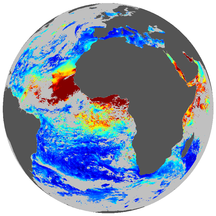
ICARE generates Level-2 Aerosol Optical Thickness (AOT) and Angström Exponent (AE) over oceans since mid-2005. These products are generated at full resolution for each MSG observation (i.e. every 15th minutes) and a daily average is computed. They are made available in near real-time in HDF4 format from the ICARE web site (archive and NRT).
In addition, ICARE provides browse images associated with the generated products. Imagery over the whole SEVIRI archive (2004 to present) is available through ICARE’s multi-sensor browse interface and geostationary browse interface, and can be compared to many other data sets, including the GEMS/MACC aerosol forecast, to facilitate observation/model comparisons.
| Product Name | Product Group | Description |
|---|---|---|
| SEV_AER-OC-L2 | Aerosol over Ocean | Level-2 Aerosol Products (AOT and AE) over Ocean |
| SMAOL-L1B | Land Reflectance | Level-1B TOA Reflectance (Pre-processing) |
| SEV_SMAOL_REFL_RATIO | Land Reflectance | Level-2 surface reflectance ratio NIR16/VIS06 (Pre-processing) |
| SEV_SMAOL-SURF-REFL | Land Reflectance | Level-2 Surface reflectance, after aerosol correction (Pre-processing) |
| SEV_SMAOL-BRDF-L3-15DAYS | Land Reflectance | Level-2 Bidirectional surface reflectance – BRDF (Pre-processing) |
| SEV_SMAOL-AOT | Aerosol over Land | Level-2 Aerosol Optical Thickness over Land |
Data Access and Browse Imagery
- The ICARE Multi-sensor browse interface
- The ICARE geostationary browse interface
- The ICARE Archive (Registration required)
References
[1] F. Thieuleux, C. Moulin, F. M. Bréon, F. Maignan, J. Poitou and D. Tanré : Remote Sensing of Aerosols over the oceans using MSG/SEVIRI Imagery, Ann. Geophys., 23, 3561-3568, doi:10.5194/angeo-23-3561-2005
[2] F. Thieuleux (in French): Code de traitement des mesures pleine résolution Meteosat – Inversion des paramètres optiques des aérosols sur mer – Manuel utilisateur
[3] Bréon, FM, A. Vermeulen, J. Descloitres: An evaluation of satellite aerosol products against sunphotometer measurements. Remote Sensing of Environment (2011), doi:10.1016/j.rse.2011.06.017
![]()