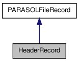
#include <parasolfilerecord.h>


Public Member Functions | |
| HeaderRecord () | |
| constructor : put the end-of-string characters | |
| void * | get_entry (const int &entry_index, const vector< int > v_ival=vector< int >(0)) |
| access to each attribute for writing it For example, this used for reading the L1 technological parametres. If you want to access to the image "im" in the sequence "is", v_ival will be ["is","im"] | |
Public Attributes | |
| char | phone_nb [16+1] |
| char | product_id [16+1] |
| char | sat_id [8+1] |
| char | instr_id [8+1] |
| char | spatial_cover [16+1] |
| char | pix_size [8+1] |
| char | ellips_name [30+1] |
| char | ellips_minor_axis_len [12+1] |
| char | ellips_major_axis_len [12+1] |
| char | DEM_name [30+1] |
| char | DEM_spatial_res_lat [8+1] |
| char | DEM_spatial_res_lon [8+1] |
Detailed Description
Store the PARASOL header record values.
Member Function Documentation
| void * HeaderRecord::get_entry | ( | const int & | entry_index, | |
| const vector< int > | v_ival = vector <int>(0) | |||
| ) | [virtual] |
access to each attribute for writing it For example, this used for reading the L1 technological parametres. If you want to access to the image "im" in the sequence "is", v_ival will be ["is","im"]
- Parameters:
-
entry_index the index of the entry in the record v_ival the indexes of the value to read, stored as a vector
- Returns:
- a pointer to the attribute to read
Implements PARASOLFileRecord.
References DEM_name, DEM_spatial_res_lat, DEM_spatial_res_lon, ellips_major_axis_len, ellips_minor_axis_len, ellips_name, instr_id, phone_nb, pix_size, product_id, PARASOLFileRecord::rec_len, PARASOLFileRecord::rec_nb, sat_id, and spatial_cover.
Member Data Documentation
| char HeaderRecord::DEM_name[30+1] |
Name of the DEM used for the data registration
Referenced by get_entry(), and PARASOLLeader::print_header().
| char HeaderRecord::DEM_spatial_res_lat[8+1] |
Spatial resolution of the DEM along the latitudes
Referenced by get_entry(), and PARASOLLeader::print_header().
| char HeaderRecord::DEM_spatial_res_lon[8+1] |
Spatial resolution of the DEM along the longitudes
Referenced by get_entry(), and PARASOLLeader::print_header().
| char HeaderRecord::ellips_major_axis_len[12+1] |
Length of the ellipsoid major axis
Referenced by get_entry(), and PARASOLLeader::print_header().
| char HeaderRecord::ellips_minor_axis_len[12+1] |
Length of the ellipsoid minor axis
Referenced by get_entry(), and PARASOLLeader::print_header().
| char HeaderRecord::ellips_name[30+1] |
Name of the ellipsoid used for the data registration
Referenced by get_entry(), and PARASOLLeader::print_header().
| char HeaderRecord::instr_id[8+1] |
Instrument identificator
Referenced by get_entry(), and PARASOLLeader::print_header().
| char HeaderRecord::phone_nb[16+1] |
Information Point Phone Number
Referenced by get_entry(), and PARASOLLeader::print_header().
| char HeaderRecord::pix_size[8+1] |
Pixel size of the POLDER/Parasol grid
Referenced by get_entry(), and PARASOLLeader::print_header().
| char HeaderRecord::product_id[16+1] |
Product Identification
Referenced by get_entry(), and PARASOLLeader::print_header().
| char HeaderRecord::sat_id[8+1] |
Satellite identificator
Referenced by get_entry(), and PARASOLLeader::print_header().
| char HeaderRecord::spatial_cover[16+1] |
Spatial Coverage
Referenced by get_entry(), and PARASOLLeader::print_header().
The documentation for this class was generated from the following files:
- /home/pascal/depot/filedata/src/parasolfilerecord.h
- /home/pascal/depot/filedata/src/parasolfilerecord.cpp
 1.7.1
1.7.1