Public Member Functions | |
| PMFileData (const string &name, const string &mode="r") | |
| constructor | |
| ~PMFileData () | |
| destructor | |
| void | load_geolocation_data () |
| read the geolocation data (latitude, longitude and time) This method is used to make the search of the indexes of a (lat,lon,time) point faster. | |
| void | free_geolocation_data () |
| free eventually loaded geolocation data If the geolocation data are not loaded, doesn't do anything | |
| const bool | contain_location (const float &lat, const float &lon, const double &tolerance=0.01) |
| check if this file has eventually data coincident with (lat,lon) Actually, it only tests if (lat,lon) is contained in the data's bounding rectangle. | |
| const bool | contain_data (const float &lat, const float &lon, const double &time, const double &colocation_tolerance=0.01) |
| check if the file has possible (lat,lon) coincidence | |
| const float | get_nearest_point_distance (const float &lat, const float &lon, const float coloc_tolerance=PMFileData::colocation_tolerance) |
| compute the distance to (lat,lon) of the nearest point in the data | |
| string | get_product () const |
| access to the product name | |
| string | get_version () const |
| access to the version of the product | |
| const bool | get_index (const float &lat, const float &lon, int igrid[2], const float colocation_tolerance=0.01) |
| find the index of the nearest point to (lat,lon) in the data. If (lat,lon) is not found or out of the colocalisation_frame, returned indexes are [-1,-1] | |
| const bool | get_index (const float &lat, const float &lon, int &idata, const float colocation_tolerance=0.01) |
| find the index of the nearest point to (lat,lon) in the data. The resulting index is linearized : if the dataset has 2 dimensions, this index will be "i_x + sz_x * i_y" If (lat,lon) is not found or out of the colocalisation_frame, returned indexes are [-1,-1] | |
| virtual void | get_vindex (vector< vector< int > > &v_index, const float &lat, const float &lon, const float colocation_tolerance=0.01) |
| build the list of indices of pixels that are in colocation tolerance, sorted by increasing distance to (lat,lon) If (lat,lon) is not found or out of the colocalisation_frame, returns an empty vector | |
| const int | get_nb_geo_points () |
| retrieve the number of (lat,lon) pixels in the file | |
| virtual void | load_v_pixel () |
| load the list data pixels Unused for this type of product | |
| virtual void | close_data_file () |
| closes the file. | |
| virtual void | open_data_file () |
| opens the file. | |
| virtual void | get_pixel_coord (const vector< int > &ipix, float &lat, float &lon, double &time) |
| retrieve the coordinates of a pixel using its index. Actuallty, the data are gridded, so the ( lat, lon ) position returned is the center of the grid cell | |
| int | get_orbit_nb () const |
| orbit number getter | |
| void | geolocation_to_grid (const float *lat_lon, int *igrid) |
| get the full resolution polder grid indexes corresponding to a point given by its (lat,lon) coordinates | |
| void | geolocation_to_grid (const float &lat, const float &lon, int *igrid) |
| get the full resolution polder grid indexes corresponding to a point given by its (lat,lon) coordinates | |
| void | grid_to_geolocation (const int *igrid, float *lat_minmax, float *lon_minmax=NULL) |
| get the lat,lon extrema for a grid point if the indexes are out of the grid or not valid, lat_minmax and lon_minmax are set to -1. | |
| const int16 * | get_irow_shift_data () const |
| getter of the column shift for each row data | |
| float32 | get_node_lon () const |
| getter of the ascending node longitude | |
| void | read_node_lon () |
| read the ascending node longitude in the file attributes and set it | |
| const bool | is_geolocation_data_loaded () const |
| check if the geolocation data have been already loaded | |
Static Public Member Functions | |
| static const int16 | get_sz_grid_y () |
| accessor to the height, in pixels, of the data grid | |
| static const int16 | get_sz_grid_x () |
| accessor to the width, in pixels, of the data grid | |
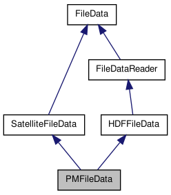
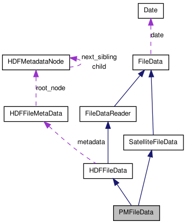
Detailed Description
Constructor & Destructor Documentation
| PMFileData::PMFileData | ( | const string & | name, | |
| const string & | mode = "r" | |||
| ) |
constructor
- Parameters:
-
name the filename mode opening mode. only "r" at this time
Member Function Documentation
| const bool PMFileData::contain_data | ( | const float & | lat, | |
| const float & | lon, | |||
| const double & | time, | |||
| const double & | colocation_tolerance = 0.01 | |||
| ) | [virtual] |
check if the file has possible (lat,lon) coincidence
- Warning:
- it's an EVENTUAL coincidence. That is not a proof !!!
- Parameters:
-
lat latitude lon longitude time time colocation_tolerance the acceptable bias (in km or degrees. Supposed to be in, a plane approximation) between [lat,lon] and the nearest data point.
- Returns:
- true if can eventually contain a coincidence with the point.
- Warning:
- at this time always true. I don't have a good way to do it
Reimplemented from FileData.
References contain_location(), and FileData::contain_time().
| const bool PMFileData::contain_location | ( | const float & | lat, | |
| const float & | lon, | |||
| const double & | tolerance = 0.01 | |||
| ) | [virtual] |
check if this file has eventually data coincident with (lat,lon) Actually, it only tests if (lat,lon) is contained in the data's bounding rectangle.
- Parameters:
-
lat the latitude of the event lon the longitude of the event tolerance acceptable bias between the nearest point in the data and the given (lat,lon) point
- Returns:
- true if a point in the data has been found in the colocation frame
Reimplemented from FileData.
References get_index().
Referenced by contain_data().
| void PMFileData::geolocation_to_grid | ( | const float * | lat_lon, | |
| int * | igrid | |||
| ) |
get the full resolution polder grid indexes corresponding to a point given by its (lat,lon) coordinates
- Parameters:
-
lat_lon the geolocation coordinates igrid the indexes in the reference POLDER full resolution grid, in the format [line,col] and starting from 1
Referenced by geolocation_to_grid().
| void PMFileData::geolocation_to_grid | ( | const float & | lat, | |
| const float & | lon, | |||
| int * | igrid | |||
| ) | [inline] |
get the full resolution polder grid indexes corresponding to a point given by its (lat,lon) coordinates
- Parameters:
-
lat latitude lon longitude igrid the indexes in the reference POLDER full resolution grid, in the format [line,col] and starting from 1
References geolocation_to_grid().
| const bool PMFileData::get_index | ( | const float & | lat, | |
| const float & | lon, | |||
| int | igrid[2], | |||
| const float | colocation_tolerance = 0.01 | |||
| ) |
find the index of the nearest point to (lat,lon) in the data. If (lat,lon) is not found or out of the colocalisation_frame, returned indexes are [-1,-1]
- Parameters:
-
lat the latitude lon the longitude igrid the indexes of the grid cell that contains the measure. {-1,-1} if no coincidence found. colocation_tolerance the acceptable bias (in km or degrees. Supposed to be in, a plane approximation) between [lat,lon] and the nearest data point. Unused here because data are gridded
- Returns:
- true if the coincidence has been found
Referenced by contain_location(), and get_index().
| const bool PMFileData::get_index | ( | const float & | lat, | |
| const float & | lon, | |||
| int & | idata, | |||
| const float | colocation_tolerance = 0.01 | |||
| ) |
find the index of the nearest point to (lat,lon) in the data. The resulting index is linearized : if the dataset has 2 dimensions, this index will be "i_x + sz_x * i_y" If (lat,lon) is not found or out of the colocalisation_frame, returned indexes are [-1,-1]
- Parameters:
-
lat the latitude lon the longitude idata the linearized index of the nearest measure. -1 if no coincidence found. colocation_tolerance the acceptable bias (in km or degrees. Supposed to be in, a plane approximation) between [lat,lon] and the nearest data point. Unused here because data are gridded
- Returns:
- true if the coincidence has been found
References get_index().
| const int16* PMFileData::get_irow_shift_data | ( | ) | const [inline] |
getter of the column shift for each row data
- Returns:
- the column shift data buffer
| const int PMFileData::get_nb_geo_points | ( | ) | [inline] |
retrieve the number of (lat,lon) pixels in the file
- Returns:
- the number of (lat,lon) pixels
| const float PMFileData::get_nearest_point_distance | ( | const float & | lat, | |
| const float & | lon, | |||
| const float | coloc_tolerance = PMFileData::colocation_tolerance | |||
| ) | [inline] |
compute the distance to (lat,lon) of the nearest point in the data
- Warning:
- this method does not make sense for a gridded product. This code is here only to implement the interface
- Parameters:
-
lat the latitude lon the longitude coloc_tolerance the -/+ maximal tolerance for 2 points considered as colocated
- Returns:
- the distance to the nearest point, or -1 if no point in the colocalisation frame has been found.
| float32 PMFileData::get_node_lon | ( | ) | const [inline] |
getter of the ascending node longitude
- Returns:
- the ascending node longitude
| int PMFileData::get_orbit_nb | ( | ) | const [inline] |
orbit number getter
- Returns:
- the orbit number
| virtual void PMFileData::get_pixel_coord | ( | const vector< int > & | ipix, | |
| float & | lat, | |||
| float & | lon, | |||
| double & | time | |||
| ) | [inline, virtual] |
retrieve the coordinates of a pixel using its index. Actuallty, the data are gridded, so the ( lat, lon ) position returned is the center of the grid cell
- Parameters:
-
ipix [IN] index of the pixel lat [OUT] latitude of the pixel lon [OUT] longitude of the pixel time [OUT] timestamp of the pixel. Unused for this product
References grid_to_geolocation().
| string PMFileData::get_product | ( | ) | const [inline] |
access to the product name
- Returns:
- the product name
| static const int16 PMFileData::get_sz_grid_x | ( | ) | [inline, static] |
accessor to the width, in pixels, of the data grid
- Returns:
- the width of the data grid
| static const int16 PMFileData::get_sz_grid_y | ( | ) | [inline, static] |
accessor to the height, in pixels, of the data grid
- Returns:
- the height of the data grid
| string PMFileData::get_version | ( | ) | const [inline] |
access to the version of the product
- Returns:
- the version of the product
| virtual void PMFileData::get_vindex | ( | vector< vector< int > > & | v_index, | |
| const float & | lat, | |||
| const float & | lon, | |||
| const float | colocation_tolerance = 0.01 | |||
| ) | [inline, virtual] |
build the list of indices of pixels that are in colocation tolerance, sorted by increasing distance to (lat,lon) If (lat,lon) is not found or out of the colocalisation_frame, returns an empty vector
- Parameters:
-
lat the latitude lon the longitude colocation_tolerance the acceptable bias (in km or degrees. Supposed to be in, a plane approximation) between [lat,lon] and the nearest data point.
- Returns:
- the list of indices of pixels
| void PMFileData::grid_to_geolocation | ( | const int * | igrid, | |
| float * | lat_minmax, | |||
| float * | lon_minmax = NULL | |||
| ) |
get the lat,lon extrema for a grid point if the indexes are out of the grid or not valid, lat_minmax and lon_minmax are set to -1.
- Parameters:
-
lat_minmax 2 elements array containing the latitude extrema. Mustn't be NULL lon_minmax 2 elements array containing the longitude extrema. Can be NULL. In this case, only lat_minmax will be computed igrid the indexes in the reference POLDER grid (line,col) and so starts from 1
Referenced by get_pixel_coord().
The documentation for this class was generated from the following files:
- /home/pascal/depot/filedata/src/pmfiledata.h
- /home/pascal/depot/filedata/src/pmfiledata.cpp