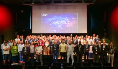
Highlights

AERIS/ICARE was migrated his good old FTP server to SFTP

For security reason, we are abandoning the FTP protocol in favor of SFTP on our distribution server. Depending of the way you are using this service, you can have to change the commands you are used to. Note that not all applications support the SFTP protocol, and some additional tools may need to be installed […]

01.03.2024

Data Summary Announcement for the release of the CALIPSO Lidar Level 2 Blowing Snow – Antarctica Version 2.00 and Greenland Version 1.00 Products

Data Release Date: January 29, 2024Version: Antarctica – Version 2.00 and Greenland – Version 1.00Data Date Range: June 13, 2006 to June 30, 2023 The CALIPSO mission team announces the release of two new CALIOP Level 2 monthly data products: The Blowing Snow monthly data products, developed by Dr. Stephen Palm, isolates blowing snow events determined from the […]

05.02.2024

Data Summary Announcement for the release of the CALIPSO IIR Level 2 Products Version 4.51

Data Release Date: September 25, 2023Version: 4.51Data Date Range: June 13, 2006 to June 30, 2023 The CALIPSO mission team announces the release of new IIR Level 2 Products: The V4.51 IIR Level 2 track and swath products use the recently released V4.51 CALIOP Level 2 layer products. Data are produced and successfully ingested at the Atmospheric Science […]

16.10.2023

CALIPSO: OFFICIAL END OF SCIENCE MISSION

After 17 years of good and loyal service, the space agencies, CNES for France and NASA for the USA agreed to end the CALIPSO science mission on August 1, 2023. This mission has been highly successful. Originally designed for a lifetime of 3 years, CALIPSO delivered unprecedented measurements of the vertical structure of the Earth’s […]

07.09.2023

Severe fire season in Canada May-July 2023

Since early May 2023, hundreds of wildfires have been raging in Canada, threatening life and causing widespread damage in buildings and natural areas. Most of Canada experienced an abnormally hot and dry spring season, which laid out the ground for wildfires to start, while windy conditions made them grow rapidly. They generated massive amounts of […]

21.07.2023

Release announcement of the V4.51 LL2 data product

The CALIPSO mission team announces the release of a new CALIOP Level 2 Product: The V4.51 CALIOP Level 2 products have a number of improvements to the characterization of smoke above clouds, single-shot (333m) cloud clearing techniques, and the stratospheric aerosol classification scheme. Two additional particulate optical depths are computed, derived over both ocean surfaces […]

12.06.2023

New GEORING Day-night imagery product available at AERIS/ICARE

ICARE is pleased to announce the first release of its new GEORING day-night imagery product. The GEORING imagery is currently generated at hourly resolution using a combination of data from the constellation of 5 geostationary meteorological satellites. The short video below illustrates 3 days of GEORING imagery from February 9th to February 11th 2023. The […]

14.03.2023

DROWN BY THE RIVER …

In late December 2022 and for most of January 2023 an atmospheric river (yellow plume over North Pacific Ocean) transported vast amount of water vapor from the tropical belt across Pacific up to west coast of North America, leading to record precipitations in California especially when it combined with the extreme event that developed on […]

06.02.2023

CALIPSO Lidar Level 1 Product Version 4.51 Data Release

The CALIPSO mission team, in collaboration with the Atmospheric Science Data Center (ASDC) at NASA Langley Research Center, announces the release of a new CALIOP Level 1 Product: CAL_LID_L1-Standard-V4-51 The product is available beginning with data from June 13, 2006 (following CALIOP first light), and as of this announcement, through December 31, 2010. Remaining data […]

08.09.2022

Search