As part of the AERIS national infrastructure for Atmospheric Research, ICARE Data and Services Centre provides various services to support the research community in fields related to atmospheric research, such as aerosols, clouds, radiation, water cycle, and their interactions. ICARE’s initial emphasis is the production and distribution of remote sensing data derived from Earth observation missions from CNES, NASA, and EUMETSAT. Our team supports the science community by developing science algorithms and production codes, building on the expertise from various partners and distributes products to the users community through various web mechanisms. Hosted by University of Lille Data Centre, our IT infrastructure is also a pilar of the Data Terra national research infrastructure for Earth Science … [Read more]
For all questions regarding the data access, the services, the registration process, a feedback on our website content or just a comment, please feel free to contact us using the link below:
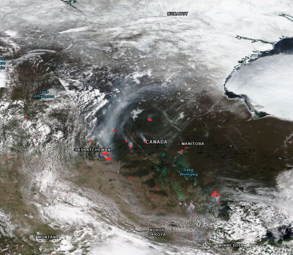
Canadian wildfires smoke crosses the atlantic ocean June 2025
Every year, Canada is affected by major forest fires. In 2025, they began in late May in the Saskatchewan region. This satellite image, taken on May 24, 2025, shows the fires in red and the smoke plumes in bluish-white. A few days later, the smoke plumes crossed the Atlantic Ocean and spread over Europe. Read more
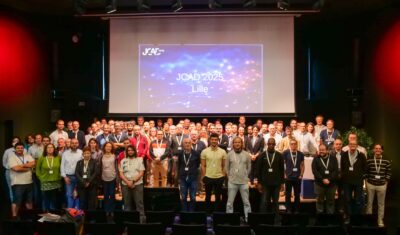
AERIS/ICARE was at the 2025 Computing and Data days
For the first time, the AERIS/ICARE team participated in and co-organized the Computing and Data Days with the University of Lille’s Mesocenter, which took place from September 15 to 17, 2025, on the campus of the Cité Scientifique in Villeneuve d’Ascq. These days bring together the French scientific community and are dedicated to both scientific […]
Highlights
AERIS/ICARE was migrated his good old FTP server to SFTP
For security reason, we are abandoning the FTP protocol in favor of SFTP on our distribution server. Depending of the way you are using this service, you can have to change the commands you are used to. Note that not all applications support the SFTP protocol, and some additional tools may need to be installed […]
Highlights
Data Summary Announcement for the release of the CALIPSO Lidar Level 2 Blowing Snow – Antarctica Version 2.00 and Greenland Version 1.00 Products
Data Release Date: January 29, 2024Version: Antarctica – Version 2.00 and Greenland – Version 1.00Data Date Range: June 13, 2006 to June 30, 2023 The CALIPSO mission team announces the release of two new CALIOP Level 2 monthly data products: The Blowing Snow monthly data products, developed by Dr. Stephen Palm, isolates blowing snow events determined from the […]
Highlights
Data Summary Announcement for the release of the CALIPSO IIR Level 2 Products Version 4.51
Data Release Date: September 25, 2023Version: 4.51Data Date Range: June 13, 2006 to June 30, 2023 The CALIPSO mission team announces the release of new IIR Level 2 Products: The V4.51 IIR Level 2 track and swath products use the recently released V4.51 CALIOP Level 2 layer products. Data are produced and successfully ingested at the Atmospheric Science […]
Highlights
CALIPSO: OFFICIAL END OF SCIENCE MISSION
After 17 years of good and loyal service, the space agencies, CNES for France and NASA for the USA agreed to end the CALIPSO science mission on August 1, 2023. This mission has been highly successful. Originally designed for a lifetime of 3 years, CALIPSO delivered unprecedented measurements of the vertical structure of the Earth’s […]
Highlights
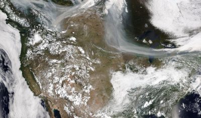
Severe fire season in Canada May-July 2023
Since early May 2023, hundreds of wildfires have been raging in Canada, threatening life and causing widespread damage in buildings and natural areas. Most of Canada experienced an abnormally hot and dry spring season, which laid out the ground for wildfires to start, while windy conditions made them grow rapidly. They generated massive amounts of […]