
Fires in Greece, August 2007
Large forest fires erupted in Greece’s Peloponnesus Peninsula on August 24th, 2007, producing thick plumes of smoke over the Ionian Sea. Several remote sensing images and products available from the ICARE archive helped users analyze that event.
MSG/SEVIRI
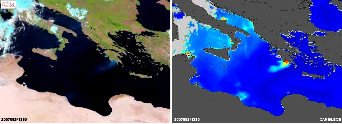
This animation shows an early example of enhanced aerosol product developed by ICARE/LSCE (currently under development). Smoke appears in blue over black water in the RGB image (left). Smoke retrieved optical thickness ranges from 0 (blue) to 2.0 (red) in the Aerosol Optical Thickness product (right)
MSG/SEVIRI products are generated in near-real-time by ICARE, and distributed to the ICARE users after 24hrs (due to licensing limitations). ICARE’s MSG/SEVIRI archived products are available here.
Note: This animation is encoded in Microsoft MPEG-4 format (most widely supported). MAC OS X users may need to download and install VLC to view this animation in Quicktime.
Image credit: ICARE/LSCE – Data: EUMETSAT
CALIPSO/CALIOP
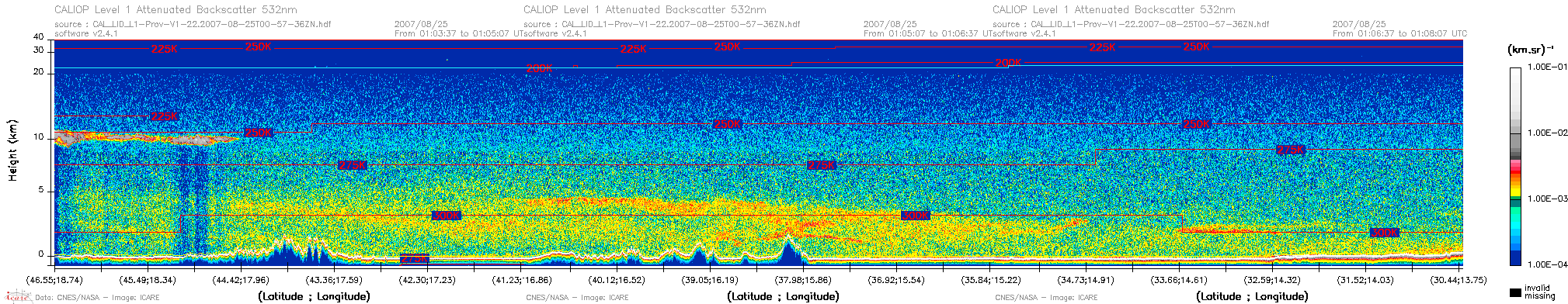
The CALIOP lidar onboard the CALIPSO satellite provides the vertical distribution of the aerosol layer along the satellite subtrack. Aerosols appear as a yellow-to-red speckle (altitude ranging from 0 to 5 km), while clouds appear as solid grey. The blue-green speckle corresponds to a residual signal from the clear atmosphere. Sharp variations of the surface signal at the bottom of the profile correspond to montains.
CALIPSO products are routinely retrieved from NASA and distributed to ICARE users through a dedicated interface available here.
Image credit: ICARE – Data: NASA
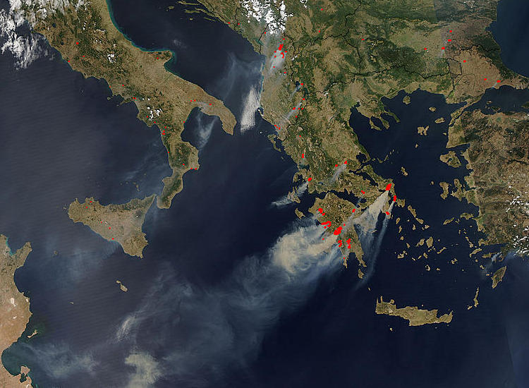
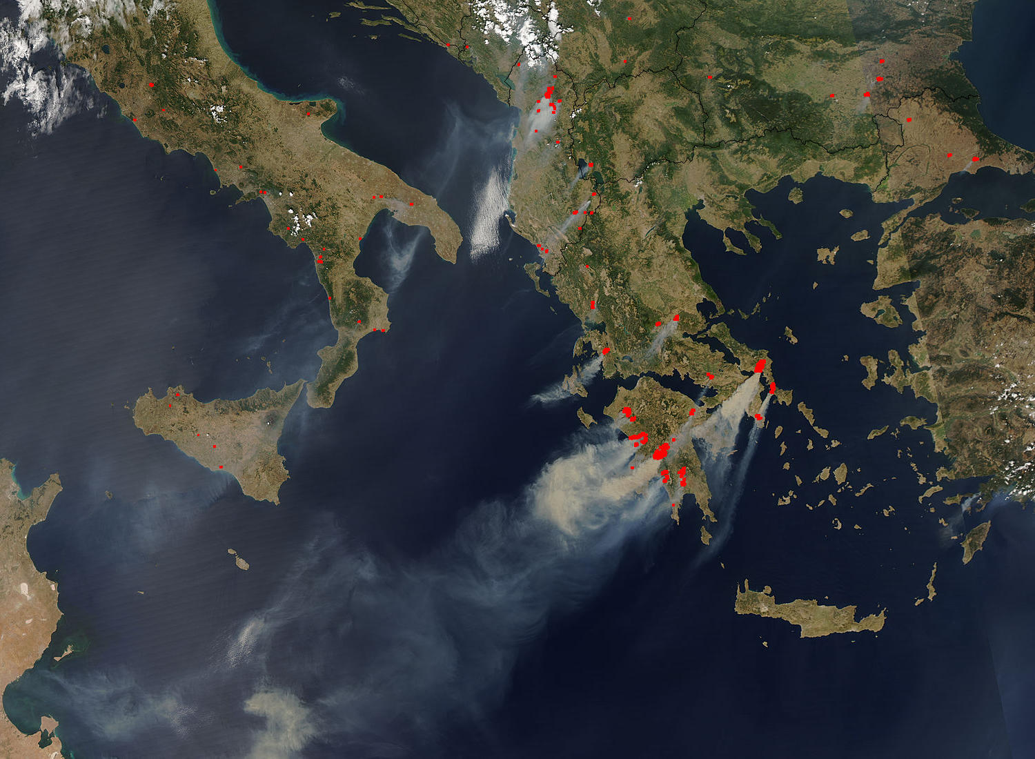
Aqua/MODIS
This true-color image made from the MODIS instrument onboard the Aqua satellite shows smoke rising from forest fires across the Peloponnesus Peninsula. The red dots (at 2km/1km resolution) or outlines (at 500m/250m resolution) indicated the location of the active fires.
Image credit: ICARE / NASA MODIS Rapid Response Project
