New GEORING Day-night imagery product available at AERIS/ICARE

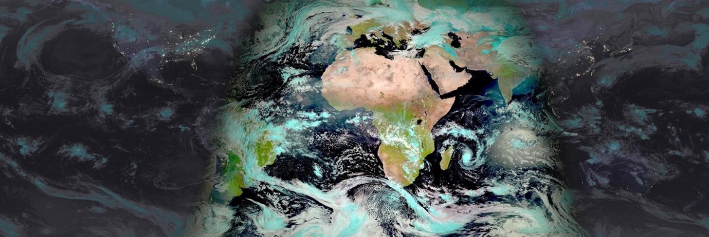
ICARE is pleased to announce the first release of its new GEORING day-night imagery product. The GEORING imagery is currently generated at hourly resolution using a combination of data from the constellation of 5 geostationary meteorological satellites.

The short video below illustrates 3 days of GEORING imagery from February 9th to February 11th 2023. The same imagery is used to provide a 5 days animation updated every day for the GEOVIEW-3D app.    

Discover this new product and all other geostationary products distributed by AERIS/ICARE through our GEOVIEW-Dataviz and GEOVIEW-3D visualization applications or directly at https://www.icare.univ-lille.fr/asd-content/archive/?dir=GEO/GEO-RING.v1.00/

As for all other products and data distributed by AERIS/ICARE, the archive of geostationary level-1 data and derived products is also directly available under: https://www.icare.univ-lille.fr/asd-content/archive/?dir=GEO/

More news

Highlights

AERIS/ICARE was at the 2025 Computing and Data days

For the first time, the AERIS/ICARE team participated in and co-organized the Computing and Data Days with the University of Lille’s Mesocenter, which took place from September 15 to 17, 2025, on the campus of the Cité Scientifique in Villeneuve d’Ascq. These days bring together the French scientific community and are dedicated to both scientific […]

22.09.2025

Highlights

AERIS/ICARE was migrated his good old FTP server to SFTP

For security reason, we are abandoning the FTP protocol in favor of SFTP on our distribution server. Depending of the way you are using this service, you can have to change the commands you are used to. Note that not all applications support the SFTP protocol, and some additional tools may need to be installed […]

01.03.2024

Highlights

Data Summary Announcement for the release of the CALIPSO Lidar Level 2 Blowing Snow – Antarctica Version 2.00 and Greenland Version 1.00 Products

Data Release Date: January 29, 2024Version: Antarctica – Version 2.00 and Greenland – Version 1.00Data Date Range: June 13, 2006 to June 30, 2023 The CALIPSO mission team announces the release of two new CALIOP Level 2 monthly data products: The Blowing Snow monthly data products, developed by Dr. Stephen Palm, isolates blowing snow events determined from the […]

05.02.2024

Search