New product announcement: Release of SEVIRI AERUS-GEO aerosol product – January 2015
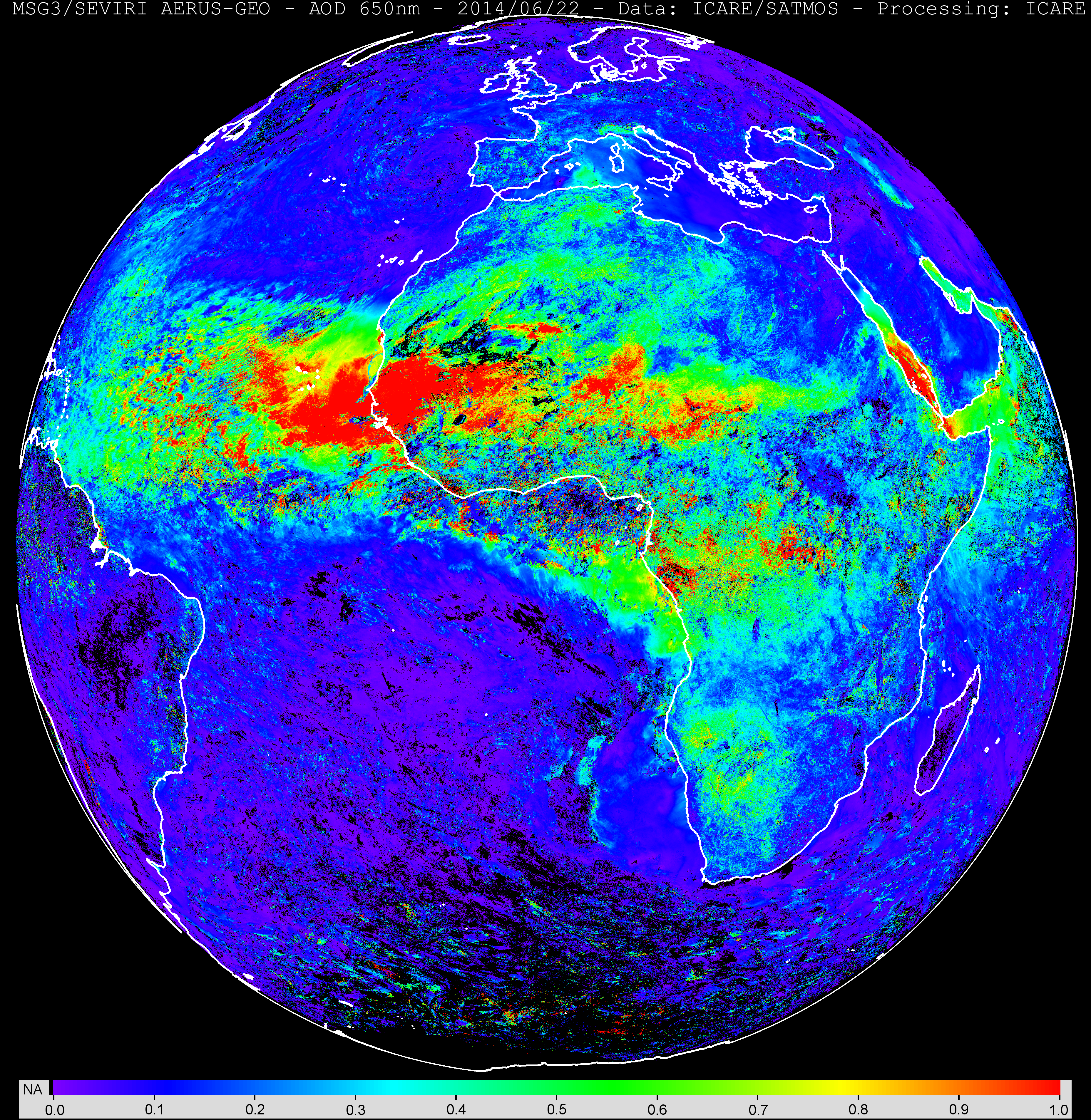
MSG/SEVIRI AERUS AOD 0.63 µm observed by SEVIRI
Image credit: CNRM-GAME/ICARE.
A new SEVIRI aerosol product has been developed in the framework of a joint collaboration between Meteo France (CNRM-GAME) and ICARE. The new daily (daytime) aerosol optical depth product (SEV_AERUS-AEROSOL-NRT-D3) is public (click here to access the data from the archive interface (current version: v1.01, year 2014 until present)).
The AERUS-GEO (Aerosol and surface albEdo Retrieval Using a directional Splitting method-application to GEOstationary data) product is derived from observations from the Meteosat Second Generation (MSG) geostationary satellite covering Europe, Africa, and part of Asia and South America. The retrieval method exploits the directional information contained in the series of 96 MSG observations per day of the Earth’s disk to derive a daily mean AOD and an Angström exponent. Detailed description of the algorithm and evaluation studies are available in Carrer et al. 2010 (JGR) and Carrer el al., 2014 (see Publications). A reprocessing of the whole SEVIRI archive (2004-present) will be available soon.
This image shows an example of the retrieved aerosol optical depth during a dust storm event over West Africa on June 22, 2014. Click here for the full resolution image or here for the ICARE geostationary browse interface.


