Satellites reveal the spread of Sargassum across the Atlantic
Multum Sargassum!
In the frame of the SAREDA (SArgassum Evolving Distribution in the Atlantic) project, the Mediterranean Institute of Oceanography (MIO) and the AERIS/ICARE Data and Services Center implemented a system that monitors Sargassum in the Atlantic from space using observations from NASA’s MODIS instrument.
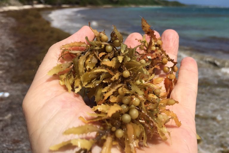
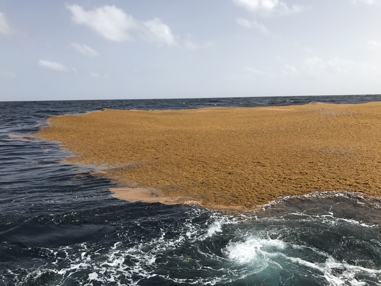
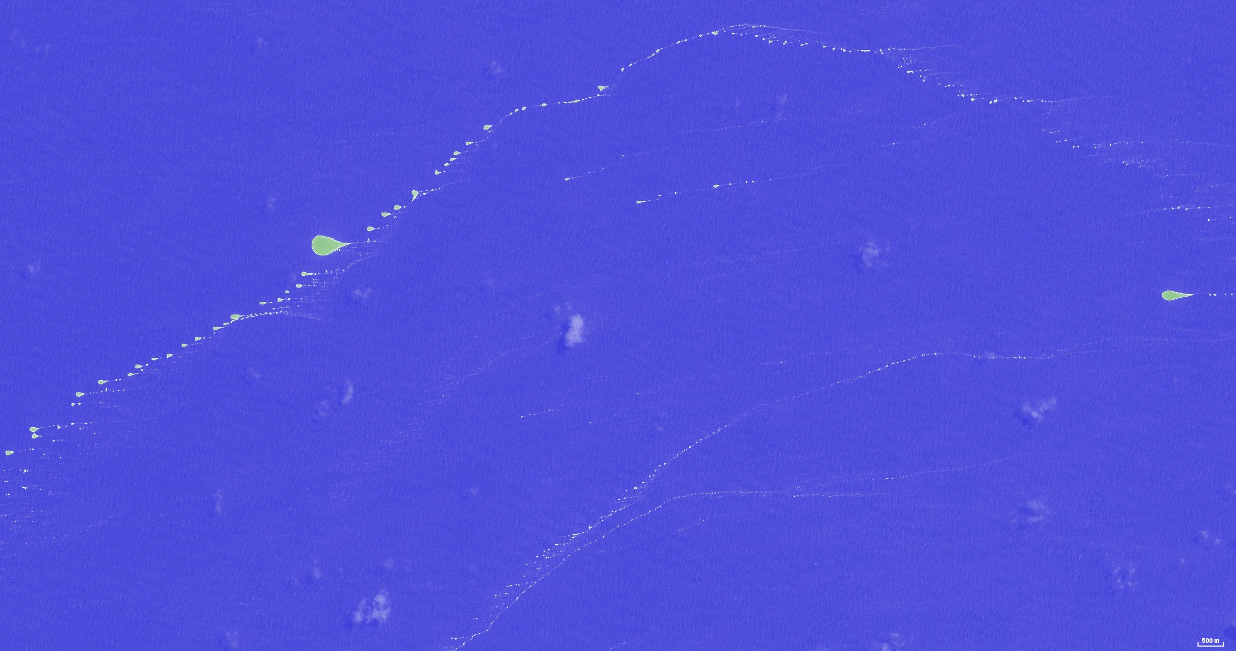
Sargassum (Sargassum fluitans et natans species) are pelagic algae, i.e. they grow in the open sea. They are made of small branches, a few tens of centimeters long, with floating bladders. They drift at the ocean surface, carried by currents and winds, and can get entangled and form large dense mats. Those aggregations usually form long lines along the wind direction (called ‘wind rows’), and can also form compact slicks several hundred meters wide. At larger scale, those structures stretch over tens of kilometers and can be visible from space. They can extend over several meters under the surface.

Source: IRD/Patrick Queneherve 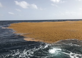
Source: MIO/OSU Pythéas/Sandrine Ruitton 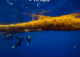
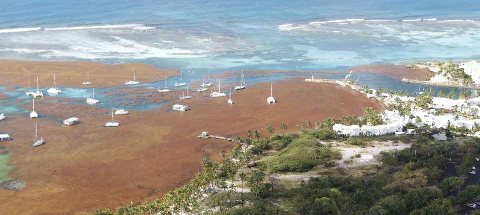
Source: Monaco Explorations/Olivier Borde

Sargassum are historically known to populate the center of the North Atlantic subtropical gyre, off Florida. However, since 2011 their region of presence changed drastically, and so did their abundance, with huge consequences. Those Sargassum now proliferate in a large tropical region of the Atlantic, from the Antilles to West Africa. When they get close to the coasts, those algae massively strand onto the beaches, harming underwater flora and fauna, fishing industry, and tourism.
Source: gouvernement.fr
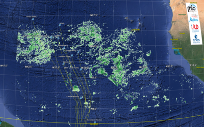
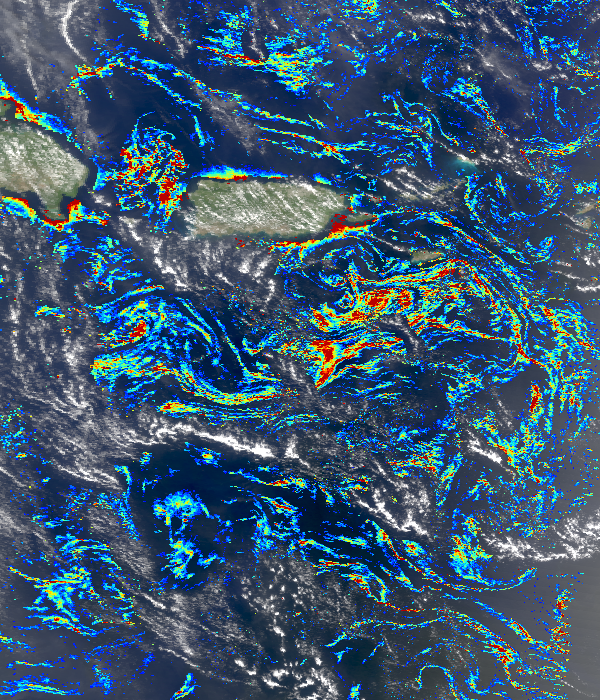
MIO scientists study the biology and the ecology of those algae, specially their transport in the Atlantic, in order to understand the origin of that proliferation, and explain the variations of their abundance over time. Routine large-scale observation over long periods of time is necessary to undertand those processes. Only remote sensing from satellites makes that possible. MIO partnered with AERIS/ICARE Data and Services Center, expert in massive processing of satellite observations, to produce daily and monthly maps of Sargassum in the regions where they are present: Gulf of Mexico, Caribbean Sea, and Atlantic Ocean.
Several satellites can observe Sargassum from space, thanks to instrumental characteristics that can reveal the presence of vegetation. For example the MSI (Multispectral Instrument) on board ESA’s (European Space Agency) Sentinel-2 satellite at 786 km altitude, with a high spatial resolution (10 m), easily reveals the Sargassum aggregations. The MODIS (Moderate Resolution Imaging Spectroradiometer) instrument on board NASA’s (National Aeronautics and Space Administration) satellite at 705 km altitude is also used for that purpose. Although MODIS spatial resolution is only 1 km, its spectral characteristics can reveal the presence of Sargassum in a 1 km pixel and provide quantitative estimates of their abundance. MODIS has the advantage to observe the region of interest almost twice a day (Terra and Aqua) since 2000, providing an opportunity to monitor the seasonal and annual variations of Sargassum.
Skippers sailing in the Atlantic know Sargassum and the trouble they cause. The big floating mats are so dense that a sailboat can hardly sail through. Sargassum get entangled in the protuding parts of the boat: keel, foils, rudders, to a point the boat drastically slows down or even stops, forcing the skipper to maneuver or even steer in reverse. Sargassum also jam the propeller of the hydrogenerator, disabling the electric power supply used for electronics and fresh water production.
During the 2020 edition of the Vendée Globe race, the skippers were surprised to encounter large amounts of Sargassum off the Cape Verde Islands in mid-November 2020, while sailing southwards. MIO and ICARE implemented a monitoring system capable to automatically produce maps of Sargassum occurrence in the Atlantic, based on MODIS observations acquired over the previous days. Those maps were made available to the Vendée Globe participants to facilitate their return route northwards. Although the skippers followed a more favorable route on the way back, they had to put up with Sargassum again.
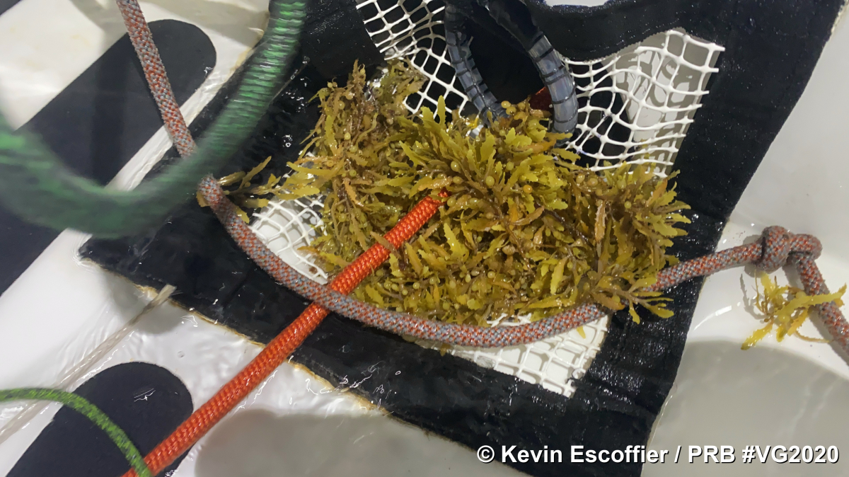
Source: Kevin Escoffier/PRB/Vendée Globe
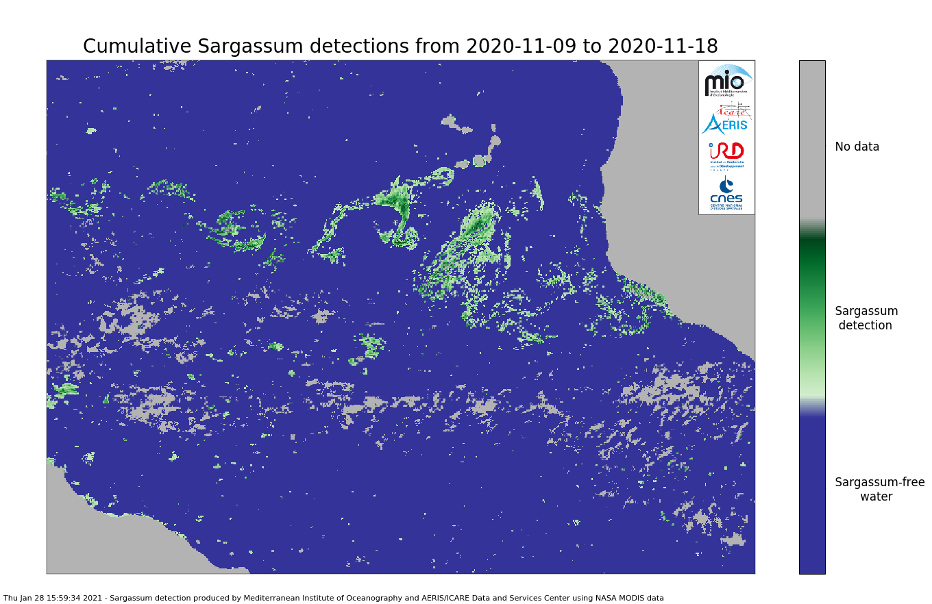
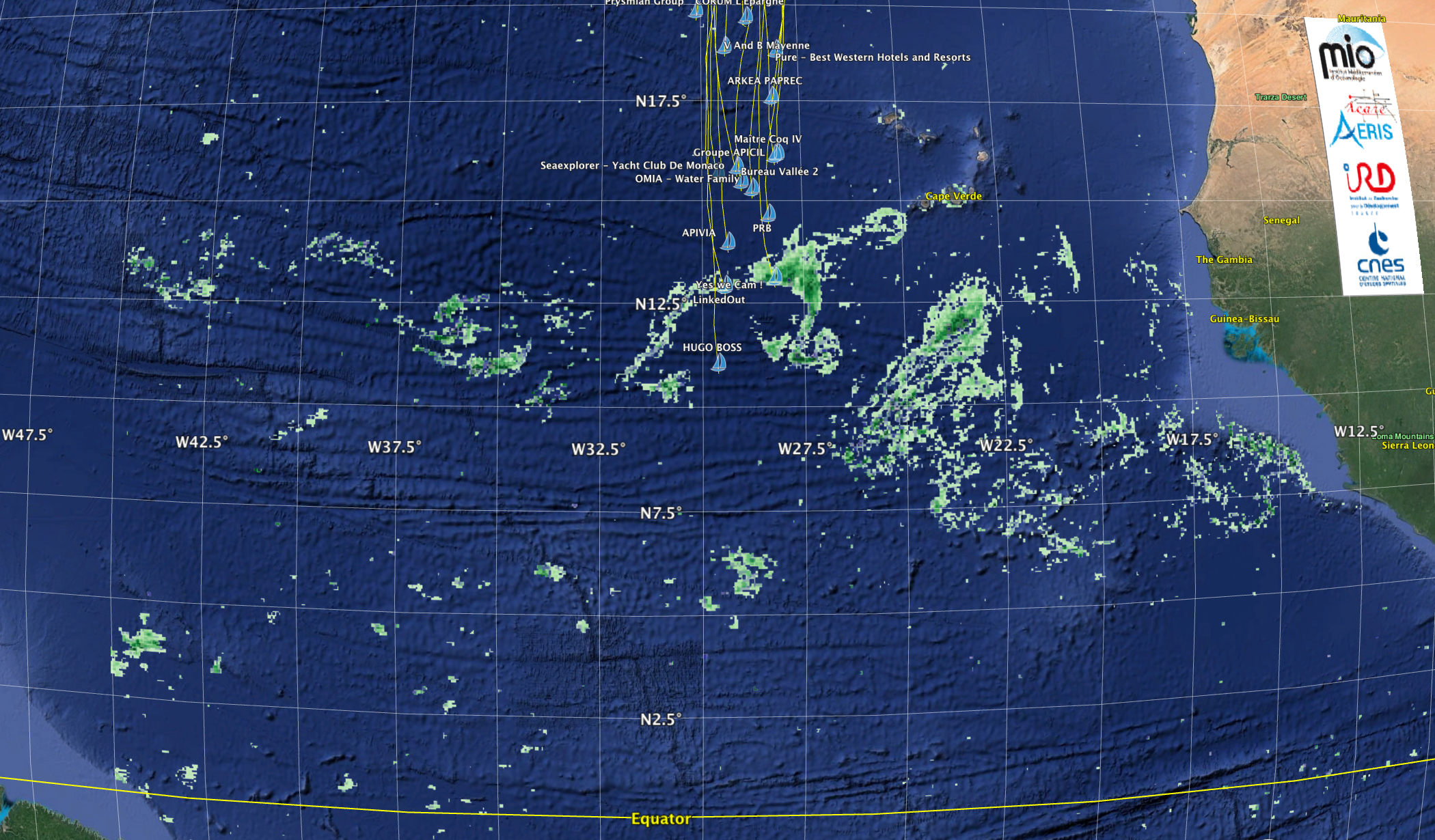
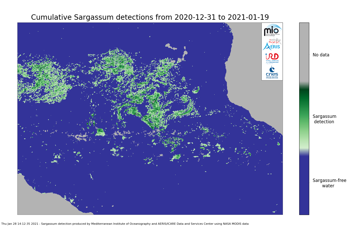

Source: AERIS/ICARE
The SAREDA project is funded by the National Centre for Space Studies (CNES) and the French National Institute for Sustainable Development (IRD). For further information, please contact Leo Berline (MIO) for questions related to science, or Jacques Descloitres (AERIS/ICARE) for technical questions.
Text and images by Jacques Descloitres, with contributions from Léo Berline.